Top 10 hiking trails in Iceland
Iceland is a popular destination for hikers, with its diverse landscapes and scenic trails.
These trails offer a mix of short day hikes and multi-day treks, showcasing Iceland’s stunning natural beauty, from waterfalls and glaciers to geothermal hot springs and volcanic landscapes.
Here are the top 10 hiking trails in Iceland:
This will be updated soon!
Distance: 4.3 miles (7 km)
Duration: 2-3 hours
Difficulty: Moderate
Best Time: Year-round (weather permitting)
Distance: 2.5 miles (4 km)
Duration: 2-3 hours
Difficulty: Easy
Best Time: Year-round
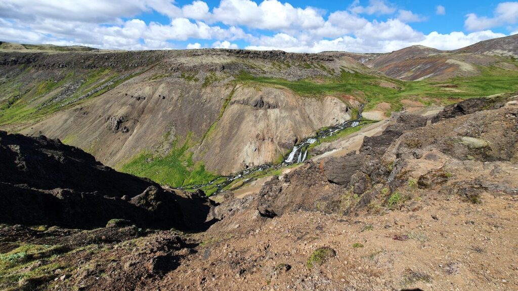
The Reykjadalur hiking trail is a popular destination for those looking to experience Iceland’s geothermal wonders up close. This trail, located near the town of Hveragerði, offers a unique opportunity to hike through a valley filled with steaming vents, bubbling mud pots, and hot springs.
The trail is approximately 3 kilometers (1.9 miles) one way and begins at a parking lot just outside Hveragerði. As you start your hike, you’ll cross a bridge over the river Varmá and follow a gravel path that winds through the picturesque Rjúpnabrekkur Ptarmigan slopes. The trail gradually ascends, providing stunning views of the surrounding landscape and the geothermal activity that characterizes the area.
One of the main highlights of the Reykjadalur trail is the natural hot river, where hikers can take a relaxing dip in the warm waters. The river’s temperature ranges from 38 to 40°C (100 to 104°F), making it the perfect spot to unwind after a hike. The hot baths in the river are a popular attraction, and there are wooden walkways and changing facilities to make the experience more comfortable.
The hike to Reykjadalur is suitable for hikers of all levels and typically takes about 45-60 minutes one way, with plenty of opportunities to stop and take photos along the way. The trail is best hiked from May to September, and it is recommended to bring swimwear and towels if you plan to enjoy the hot river.
For more detailed information and a comprehensive guide to hiking the Reykjadalur trail, check out this article Reykjadalur hot springs on GoNow.
Distance: 12 miles (20 km) round trip
Duration: 10-15 hours
Difficulty: Very Difficult
Best Time: May to September
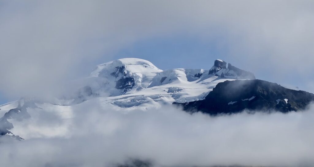
The Hvannadalshnúkur hike is an exhilarating adventure that takes you to the highest peak in Iceland, standing at 2,110 meters (6,923 feet) above sea level. Located in the Skaftafell area of Vatnajökull National Park, this challenging trail offers hikers a unique opportunity to experience the stunning beauty of Iceland’s glaciers and volcanic landscapes.
The hike begins at the Skaftafell Visitor Center, where you can gather information and prepare for the journey ahead. The trail spans approximately 22 kilometers (13.7 miles) round trip and typically takes between 10 to 15 hours to complete. As you ascend, you’ll traverse the Öræfajökull glacier, which is part of the larger Vatnajökull ice cap, the largest glacier in Europe.
Along the way, you’ll encounter breathtaking views of the surrounding mountains, ice formations, and the vast expanse of the glacier. The trail is marked by several key landmarks, including the Hvannadalshnúkur summit, which offers panoramic views of the entire region. On a clear day, you can see all the way to the south coast of Iceland and the North Atlantic Ocean.
The Hvannadalshnúkur hike is a demanding trek that requires proper equipment, including crampons and ice axes, as well as a good level of physical fitness. It is highly recommended to undertake this hike with a certified guide, as the glacier can be treacherous and weather conditions can change rapidly.
For more detailed information and guide to hiking Hvannadalshnúkur check out Hvannadalshnukur on SummitPost.
Distance: 7 miles (11.5 km) round trip
Duration: 4-5 hours
Difficulty: Moderate
Best Time: Mid-June to early September
The Kerlingarfjöll hiking trails offer an extraordinary adventure through one of Iceland’s most stunning geothermal areas. Located in the central highlands, these trails provide a unique opportunity to explore the vibrant and colorful landscapes of Kerlingarfjöll, known for its striking rhyolite mountains and geothermal activity.
The main trail in Kerlingarfjöll is the Hveradalir geothermal area hike, which spans approximately 11.5 kilometers (7 miles) round trip
This trail takes you through the heart of the geothermal area, where you can witness bubbling mud pots, steaming vents, and hot springs. The hike starts at the Kerlingarfjöll Mountain Resort and follows a zig-zagging path up into the mountains, offering breathtaking views of the surrounding landscape.
Another notable trail is the Kerlingarfjöll Hot Spring hike, which is a shorter but equally rewarding trek. This hike leads you to a natural hot spring where you can relax and soak in the warm waters while enjoying the stunning scenery. The trail is about 3 kilometers (1.9 miles) long and is suitable for hikers of all levels.
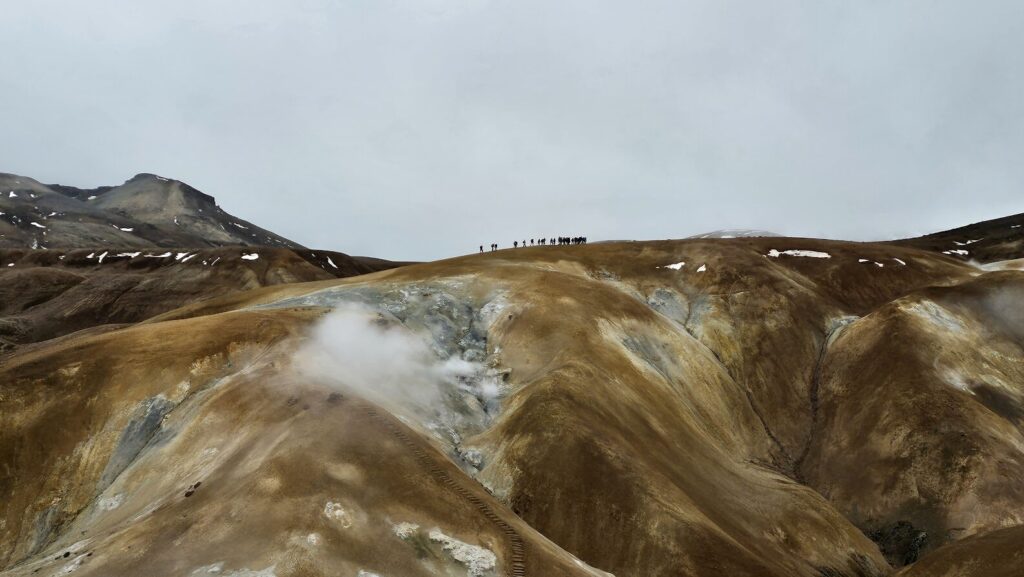
For those seeking a more challenging adventure, the Snækollur hike is a must-try. This trail takes you to the summit of Snækollur, the highest peak in the Kerlingarfjöll Mountains, offering panoramic views of both the south and north coasts of Iceland on a clear day. The hike is approximately 5 kilometers (3.1 miles) long and involves a steep ascent along a rocky mountain ridge.
Kerlingarfjöll also offers several other trails, including the Highland Base to Hveradalir hike, the Hverabotn hike, and the Skeljafell hike, each providing unique perspectives of the area’s diverse landscapes. Whether you’re looking for a short day hike or a multi-day trekking adventure, Kerlingarfjöll has something to offer for every hiker.
For more detailed information and a comprehensive guide to hiking in Kerlingarfjöll, check out Kerlingarfjöll Guide in 2025 on Epic Iceland.
Distance: Varies (e.g., Hesteyri to Hlöðuvík is 9 miles/15 km)
Duration: Multi-day hikes
Difficulty: Moderate
Best Time: Summer (accessible by boat)
The Hornstrandir Nature Reserve is a remote and pristine wilderness area in the Westfjords of Iceland, offering some of the most breathtaking and untouched landscapes for hiking enthusiasts. The trail from Norðurfjörður to Horn is a journey through rugged terrain, dramatic cliffs, and serene fjords, making it a truly unforgettable experience.
Starting in Norðurfjörður, hikers embark on a journey that takes them through the heart of Hornstrandir. The trail stretches approximately 25 kilometers (15.5 miles) and is known for its challenging yet rewarding path. As you hike, you’ll pass through lush valleys, cross mountain passes, and encounter stunning views of the surrounding fjords and the Arctic Ocean.
One of the highlights of this trail is the Hornbjarg cliffs, which are among the most striking and beautiful in Iceland. These cliffs are home to a variety of seabirds, and the views from the top are simply breathtaking. The trail also takes you through the remote and picturesque Hornvík bay, where you can camp and enjoy the tranquility of the untouched nature.
The journey concludes at Horn, a dramatic headland that offers panoramic views of the surrounding landscape. This area is known for its rugged beauty and is a perfect spot to reflect on the incredible journey you’ve just completed.
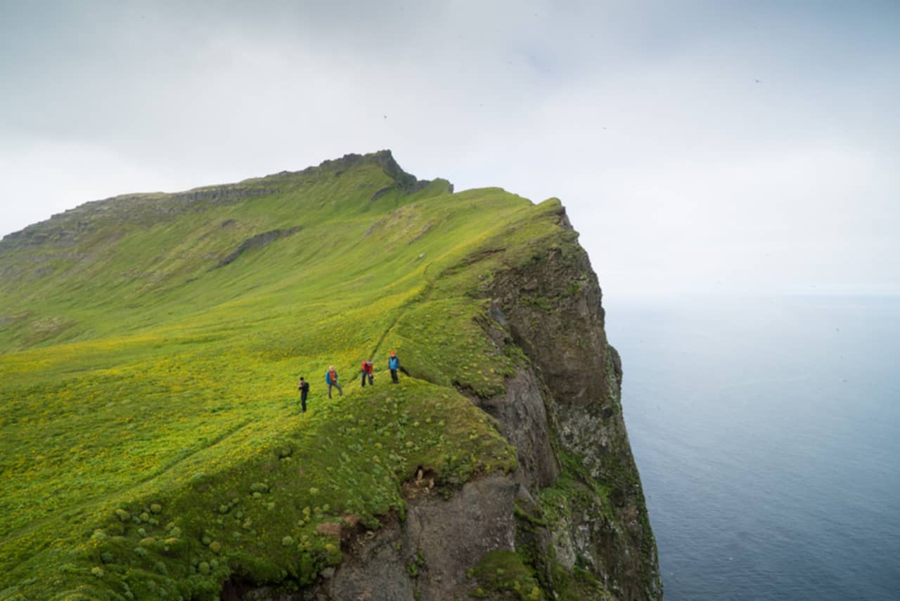
Hiking in Hornstrandir requires careful planning and preparation, as the area is remote and weather conditions can be unpredictable. However, for those willing to put in the effort, the rewards are immense. The Hornstrandir Nature Reserve offers a unique opportunity to experience Iceland’s wild and untouched beauty, making it a must-visit for any serious hiker.
For more detailed information and a comprehensive guide to hiking in Hornstrandir, check out this article on Lonely Planet The ultimate guide to Hornstrandir, Europe’s last wilderness.
Distance: 16 miles (25.7 km)
Duration: 1-2 days
Difficulty: Difficult
Best Time: Mid-June to September
The Fimmvörðuháls Trail is another spectacular hiking route in Iceland, renowned for its breathtaking scenery and diverse landscapes. This trail spans approximately 25 kilometers (15.5 miles) and begins at the iconic Skógafoss waterfall.
Starting at Skógafoss, one of Iceland’s most famous waterfalls, hikers are immediately greeted by the powerful cascade and lush green surroundings. The trail then follows the Skógá River, passing by 26 more waterfalls, each offering its own unique beauty. As you ascend, the landscape transitions from verdant greenery to a more barren, rocky terrain as you approach the ice caps.
The trail takes you between the glaciers Eyjafjallajökull and Mýrdalsjökull, traversing fresh, black volcanic soil, which is among the youngest landscapes on the planet. This section of the hike is particularly striking, with the contrast between the black soil and the surrounding ice caps creating a dramatic visual effect.
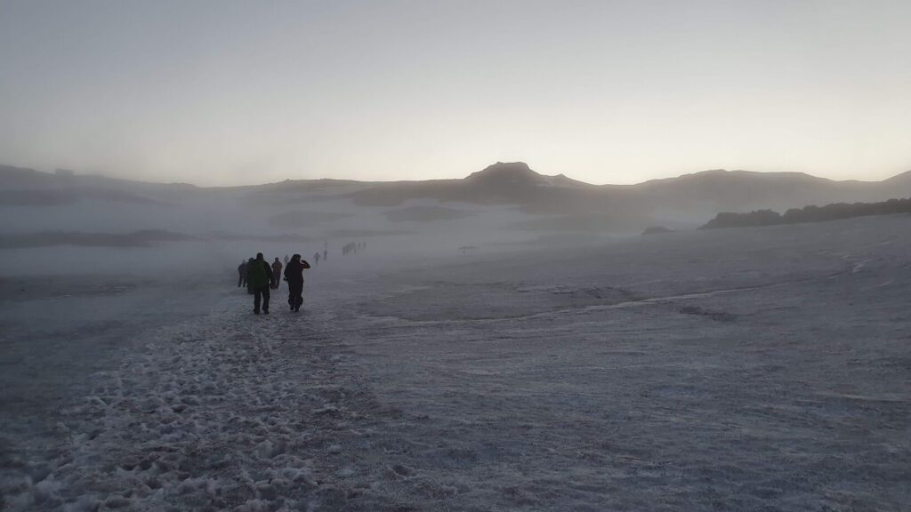
The Fimmvörðuháls Trail is a challenging hike, with a total elevation gain of 1,400 meters (4,600 feet) and typically takes between 8 to 10 hours to complete. It is best hiked from mid-June to September, and it is recommended to have proper equipment and possibly a guide if hiking outside of this season.
Whether you’re an experienced hiker or simply looking for an adventure, the Fimmvörðuháls Trail offers an unforgettable journey through some of Iceland’s most diverse and beautiful landscapes.
As you descend into Þórsmörk, the scenery changes once again. The black soil is covered with lime green moss, and eventually, you will hike through a forest before arriving at the Básar Hut in Þórsmörk[1]. This valley, named after the Norse god Thor, is surrounded by glaciers and offers stunning views of the Krossá river.
For more detailed information and a comprehensive guide to hiking the Fimmvörðuháls Trail, check out The Fimmvörðuháls Hiking Trail | Photos and Tips by Guide to Iceland.
Distance: 34 miles (55 km)
Duration: 4-6 days
Difficulty: Moderate to Difficult
Best Time: Mid-June to September
The Laugavegur Trail is a must-visit for any hiking enthusiast exploring Iceland. This iconic trail stretches approximately 55 kilometers (34 miles) between Landmannalaugar and Þórsmörk.
Starting in Landmannalaugar, known for its vibrant rhyolite mountains and geothermal hot springs, hikers are treated to a colorful and unique landscape. The trail then leads through the highlands, offering views of rugged mountains, expansive glaciers, and lush valleys. Along the way, you’ll pass through notable stops such as Hrafntinnusker, Álftavatn, and Botnar, where you can rest in mountain huts that provide basic amenities like heating and sometimes electricity and hot water.
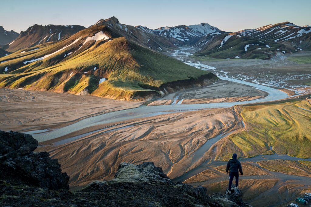
Whether you’re an experienced hiker or a nature lover, the Laugavegur Trail offers an unforgettable adventure through some of Iceland’s most spectacular landscapes. As an off-road hiking trail, it provides a rugged and immersive experience, taking you through diverse terrains that are both challenging and rewarding.
These hiking destinations offer a diverse range of landscapes and experiences, from hot springs to glaciers, rugged wilderness to scenic views. Iceland has something for every hiker, from easy day hikes to challenging multi-day treks. Remember that some of these hikes can be demanding and weather can change quickly, always check the forecast and bring appropriate gear. And it’s also important to stay on designated trails to avoid any damage to the fragile environment.
The journey concludes in Þórsmörk, a stunning valley named after the Norse god Thor. This area is surrounded by glaciers, including Eyjafjallajökull, Mýrdalsjökull, and Tindfjallajökull, and features the breathtaking Krossá river. The entire trek typically takes 4 to 5 days, with daily hikes of about 14 kilometers (roughly 8.5 miles), allowing plenty of time to soak in the incredible scenery and take memorable photos.
